


Nepal flash floods mapped: Where deadly floods hit along Tibet border
Nepal flash floods mapped: Where deadly floods hit along Tibet border

Stuti Mishra and Dan Haygarth Fri, August 28, 2026 at 10:38 AM UTC
0
Nearly 1,500 people are missing across Nepal and Tibet, authorities said on Thursday, as rescuers worked through mud and debris Friday in areas devastated by a flash flood along the Himalayan border.
They searched for hundreds of people still missing as the death toll rose.
Nepal is monitoring two lakes upstream of the flood zone, one of which began overflowing on Friday, an official with the country’s Disaster Management Authority said.
Flood risks will remain until the two lakes have fully drained, the official added.
Nepalese authorities are relying on satellite imagery to track conditions, though monitoring is limited by the availability of images, the official added.
Nepal plans to install cameras and sensors downstream, including near the border town of Timure, and is assessing deployment options by helicopter, he said
Together, Nepal and China have said more than 1,500 people are missing.
The death toll risen to 538, the Disaster Management Authority said in an update on Friday.
The authority said in an update Friday that the number of missing people remained at 977.
So far, 3,742 people have been rescued.
The authority said 14,829 security personnel have been mobilised for search and rescue operations.
Follow our live updates from Nepal here.
The disaster began when a landslide of ice and rock struck the Lhende river. This tributary meets the Bhotekoshi roughly 20km (12 miles) northeast of the Rasuwagadhi border crossing with Tibet, according to an initial analysis of satellite imagery cited by Nepal’s disaster management authorities.
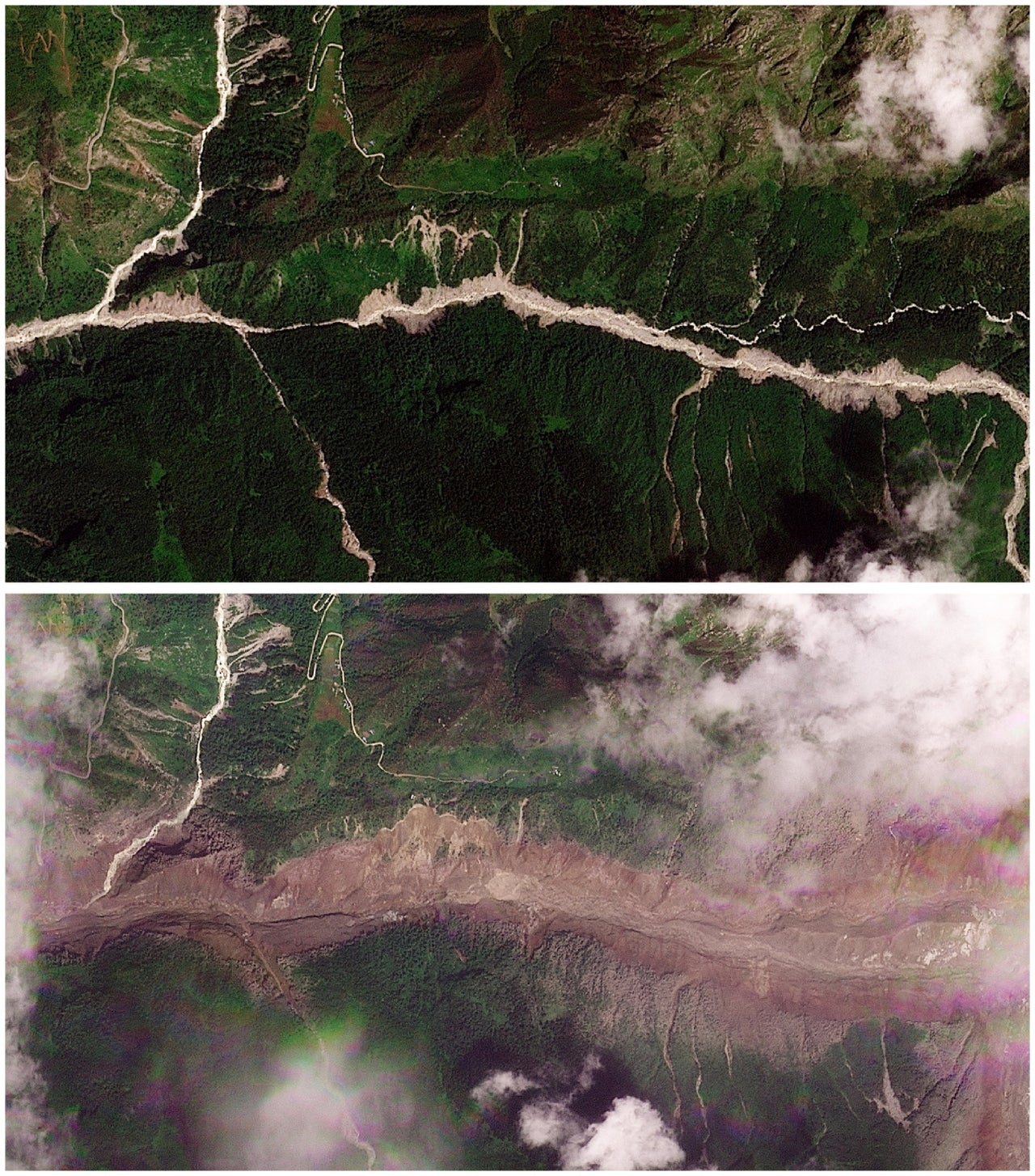
Before and after satellite images show a torrent of rock and ice high in a Nepalese mountain valley after the Nepal-China disaster (Planet Labs PBC)
The collapse sent a debris-laden surge down the Lhende into the Bhotekoshi, then into the Trishuli river, carrying mud, rock and water through the border town of Gyirong on the Tibetan side before crossing into Nepal’s Rasuwa district.
Chinese authorities have since warned of a further risk from a separate, still-dammed lake upstream of the border crossing in Gyirong county, which they said could complicate rescue efforts.
Advertisement
Villages including Manakamana and Khadga Bhanjyang, both in the flood’s direct path, were largely destroyed.
Downstream, the surge passed through Nuwakot and Dhading districts, where families gathered near an army training centre being used as a base for helicopter rescue operations.
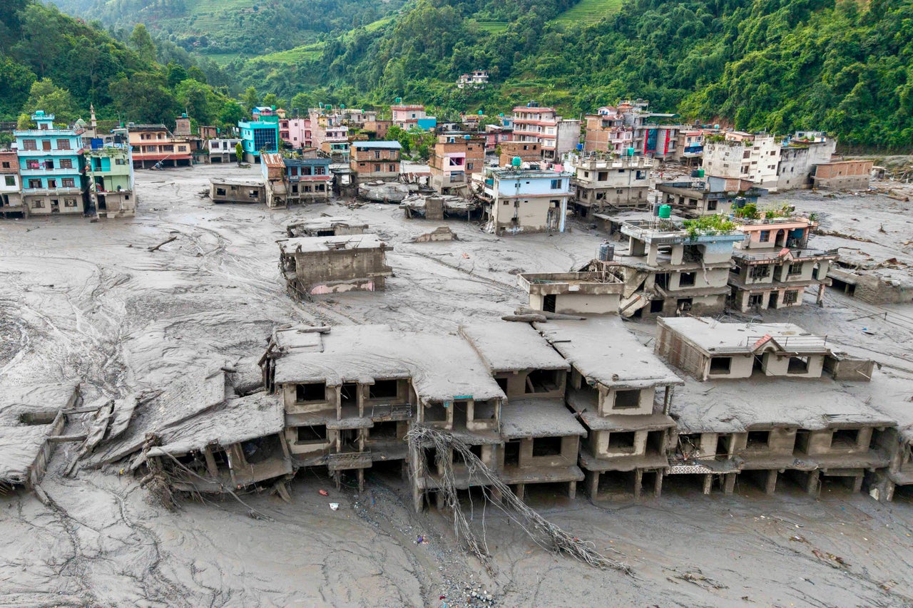
An aerial view shows houses lying deluged in sludge after flash floods at Devighat, Bidur Municipality, in Nepal’s Nuwakot district on 27 August 2026 (AFP/Getty)
Survivors described the water arriving without warning.
Keshav Prasad Baral, a 68-year-old being treated in hospital, said he tried to pull his wife to safety as mud engulfed their home. “As it got closer, it kept rising higher and higher,” he said.
“I tried to grab my wife’s hand and take her to the terrace, but she was swept away by the mud.” He was airlifted to safety four hours later.
Another survivor said he saved himself by clinging to a mango tree as he watched the house where he had been working disappear.
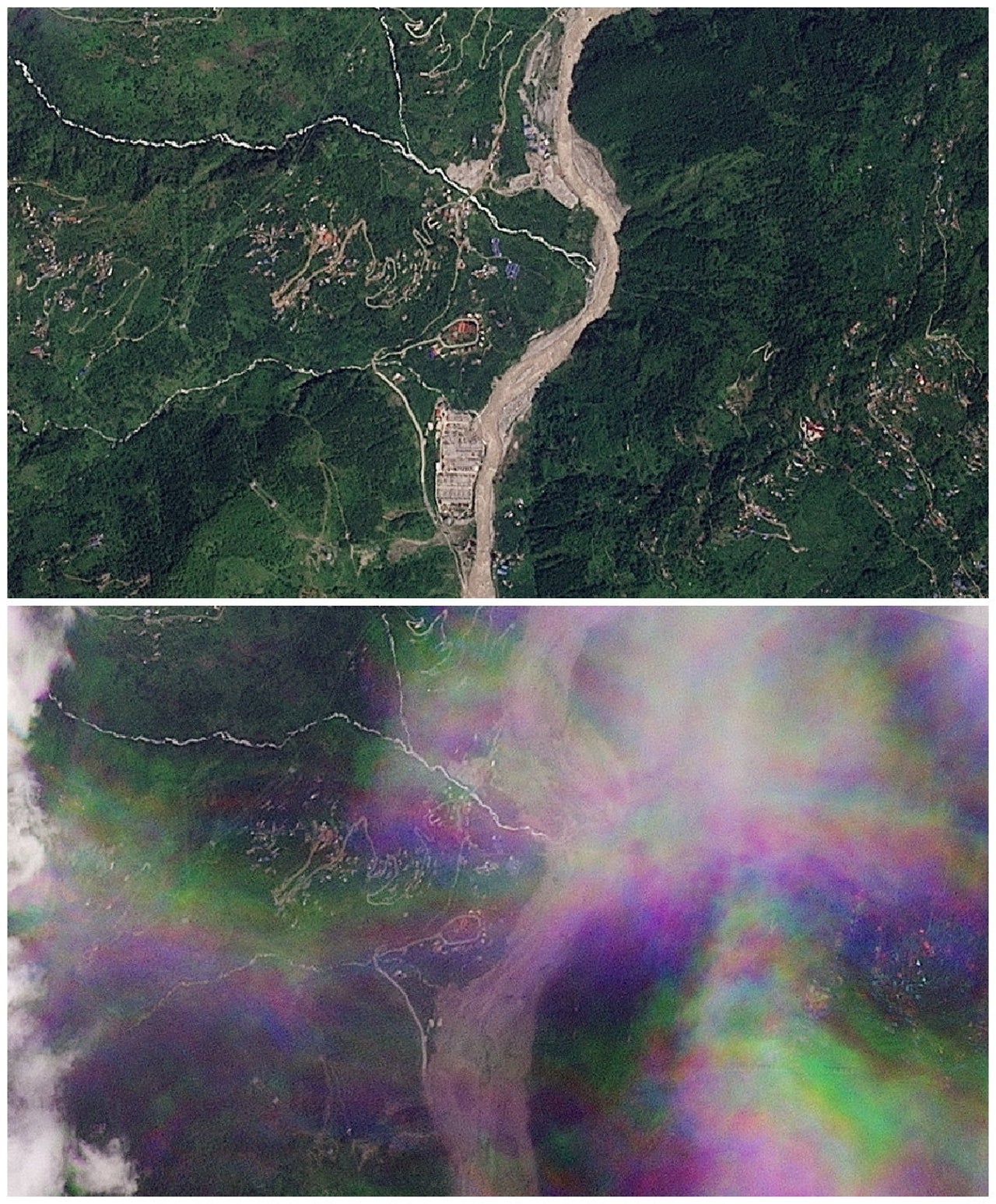
A combination of satellite images show Manakamana before and after a flash flood (Reuters)
Helicopters have been dropping tents, food and other emergency supplies provided by India to communities cut off by the disaster.
The flood’s reach has extended well beyond Nepal’s own river system. India’s National Disaster Response Force said a sudden rise in the Trishuli River was detected at Furke Khola, around 160km (99 miles) from the Indian border, and warned the flood wave was expected to continue downstream into the Gandak river.
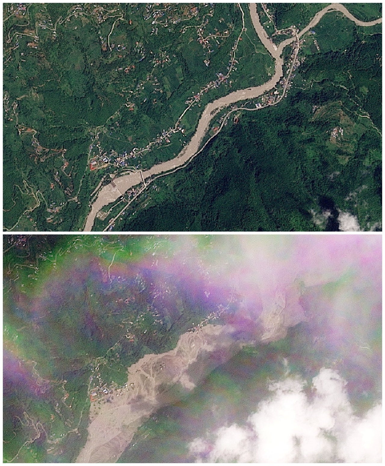
A combination of satellite images show Tupche before and after a flash flood (Reuters)
Response teams have been deployed to vulnerable districts in Bihar and Uttar Pradesh as a precaution.
Early reports had suggested a separate earthquake triggered the glacial collapse, but the US Geological Survey has since clarified that the magnitude-4.4 reading it initially logged was in fact the seismic signature of the glacial rock-and-ice collapse itself, rather than a distinct tremor that caused it.
“This is a very unique disaster, in terms of intensity and speed, which had a distinct blueprint of impact on communities, and activities around immediate response and recovery,” Nader Naderpajouh, who leads the Organising Risk and Resilience research lab and is head of the School of Project Management at the University of Sydney, said.
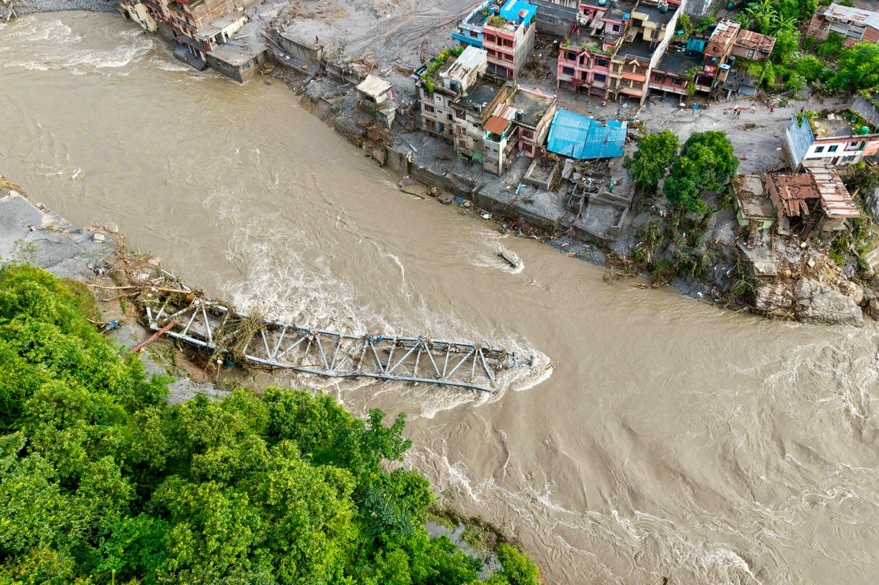
A collapsed bridge as houses are deluged in sludge after flash floods at Devighat, Bidur Municipality, in Nepal’s Nuwakot district on 27 August 2026 (AFP/Getty)
“The reports suggest the flood and landslide were caused by a buildup of water in the glacier, which was triggered by seismic activity.
“With global warming, there is an expectation that similar patterns of disasters will recur. We can benefit from the implementation of a warning system, similar to those triggered for tsunami warnings after 2004’s tsunami.”
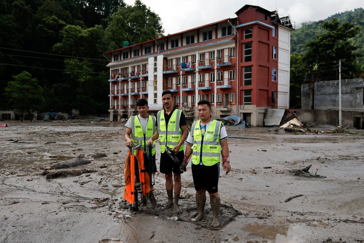
Members of a rescue team stand amid mud and debris following devastating floods, in Trishuli in Nuwakot district, Nepal, 27 August 2026 (Reuters)
The disaster has drawn pledges of support from several governments. The US said it was sending a disaster response adviser and $500,000 in assistance, while Canada, Australia and the UN have also offered help.
Indian prime minister Narendra Modi spoke to his Nepali counterpart, Balendra Shah, to convey condolences and pledge “all possible humanitarian assistance”.
Source: “AOL Breaking”
